Sunday, September 22, 2013

Just one more visit!


I couldn't help myself I had to visit the High Uintas one more time before the snow starts flying. I even cut some of my pack weight down, allowing me to travel farther and faster. As with my previous post I will list my pack contents and weights. I shaved a little over 4lbs from my pack for a grand total weight of 26lbs 15.4oz.; I hiked a little over 10 miles and did so without taking breaks. This is quite the milestone for me and I believe I can reduce my pack weight a little more each trip. I just have to overcome the "what if" nagging I put myself through each time I load my backpack. The largest weight savings came from leaving my 1lbs 6oz hiking sticks and using disposable water bottles instead of my Nalgene bottles, this saved me 12.8oz. Using the Osprey Kestrel instead of the Osprey Atmos 50 saved me 7.13oz and I left my 6.7oz bottle of bug spray home. My emergency kit has a small travel size bug spray and the bugs aren't a problem this time of year.

Pack Contents:
Osprey Kestrel 3lbs 4.6oz
High Peak Extreme PAK sleeping bag 3lbs 3.6oz
Big Agnes Fly Creek 2 2lbs 10.7oz
Emergency kit 1lbs 14.6oz
Big Agnes Insulated core sleeping pad 1lbs 8.3oz
MSR Mini works water filter 1lbs 1.7oz
Lure box 3.9oz (I cut this down from 14.1oz)
Spinning rod and reel 14.5oz
Jet boil with mess kit 15oz
Bear spray 12oz
Fly rod and reel 12.3oz
Coleman fuel canister 11.3oz
Rice dinner 6oz (smaller amount than last trip 10.1oz)
Fleece pull over 10oz
Base layer shirt 8.5oz
Base layer pants 5.1oz
Spare socks 2.9oz
Underwear 1.3oz
Bio wipes and shovel 8.1oz
Tarp 7.8oz
2 Aquavista 16.9oz plastic bottles 2lbs 4.6oz
Small Fly box 3oz
Large Fly box 5.4oz
50' rope 7.8oz
Head lamp 2.9oz (used my smaller one, left heavier one 4.6oz)
Memory foam sleep pad (protection for inflatable pad) 6.8oz
Rain gear top 6oz
Rain gear bottom 4.4oz
GPS 5.2oz
Tooth brush, paste and soap kit 3.3oz
Silva Ranger compass 2.6oz
Gloves 2.1oz
Watch cap 1.8oz
Sit pad (small piece of foam from a old sleeping mat) 1.7oz

Total weight 26lbs 15.4oz


I was quite delighted with my new pack weight and I couldn't wait to load the car. I pointed the car south and headed for the Crystal Lake trail head. My destination was Island Lake in the Provo river drainage. I made it to the trail head and was on my way at 1 pm; I made it to the first junction at 1:30 pm.


 About ten minutes later I arrived at Long lake.


I arrived at the next trail junction at 2:24pm.

 
I arrived at Island lake at 2:40pm covering 3.5 miles in 1 hour and 40 minutes.


What a beautiful lake!


A few really nice cliffs and one really large boulder! 


The Island of Island lake. 

 
Another view of the Island.


Nice 25' drop, from what I have read people like to cliff dive here. It would have to be a really hot day for me to dive into an ice cold 10000ft lake! 

 
Awesome views!


I fished for a couple hours, but the wind made fly fishing extremely difficult. Unfortunately I did not catch any fish here at all! It was awesome to see fish swimming around when on top of the cliffs though.


Since I didn't do well at Island I decided to hit my old standby, Weir Lake. I was back on the trail at 4:30 and made good time back to Long Lake. Once at Long Lake I headed west towards Long pond and followed the drainage to Weir. I am glad I did! I found a short gorge with several 10' waterfalls; I'll bet it's a sight to behold in early summer during the run off. I may have to start planning a return trip in early June.


First look at Weir lake. 


Wild mountain raspberry. 

 
Only a couple left!


Last three sets of waterfalls. 


Weir lake.


Now this is an old Shasta Orange soda can, I saw next to the damn at the outlet. I thought about packing it out but since it may have been left by the guys who build the dam I was afraid I would be arrested for removing an artifact for Forest service land. If you think I am crazy call and ask a park ranger what will happen if you take something from a national park, that's drama I can live without! I took only a pictures of the can as it was found.


I took this picture of the setting sun at 7:05 pm and hit the trail soon after. There was intermittent rain drops falling and I wasn't tired, so I bagged the idea of spending the night and packing out a wet tent.


I made it to the car at 8:11 pm, covering the last three miles in about an hour. I hiked just a little over ten miles for the whole trip, even with a nasty bruise on the bottom of my right foot. I had a blast and the last sunset made my trip!


Packslinger.

Sunday, September 1, 2013


Hidden Lake


My son and I were planning on checking out one of the many hidden lakes in Utah. The Hidden lake we choose was the near Wall lake and Mount Watson in the High Uintas. Every time I have been to that trailhead I have always passed it by on my way to other lakes. Well with this being the last major weekend of the summer and an upcoming surgery, I thought I better hit the trail one more time. I wanted to see another set of lakes! After my week long trek in the Wind River range of Wyoming I wanted to lighten my pack, so I laid everything out and using my postage scale I weighed it all. Below is the contents of my pack with corresponding weights.

Osprey Atmos 50 size large 3 LBS 8.5 OZ
High Peak Extreme Pak 3 LBS 3.6 OZ
Nalgene water bottle full 2LBS 11 OZ X 2
Fly creek UL2 tent 2 LBS 10.7 OZ
Emergency kit 1 LBS 14.6 OZ
Big Agnes insulated core sleeping pad 1 LBS 8.3 OZ
MRS Mini Works water filter 1 LBS 1.7 OZ
Lure box 14.1 OZ
Spinning rod and reel 13.4 OZ
Jet Boil SOL 12.2 OZ (15 OZ with rag, Salt/Pepper, and two spoons)
Bear Spray 12 OZ
Fly rod and reel 12 OZ
Coleman Fuel Canister 11.3 OZ
Rice Dinner (Two cups rice and 1 Lipton soup packet in a Ziploc bag) 10.1 OZ
Fleece pull over 10 OZ
Sherpa base layer shirt 8.5 OZ
Coleman BIO wipes and shovel in Ziploc bag 8.1 OZ
Outdoor Products Silicone tarp 7.8 OZ
50' rope 7.8 OZ
Repel Bug spray 6.7 OZ
Memory foam pad (protection for my Big Agnes sleeping pad) 6.8 OZ
Rain top 6 OZ
Fly box with large Flies 5.4 OZ
GPS 5.2 OZ
Base layer pant 5.1 OZ
Head Lamp 4.6 OZ
Pack cover 4.4 OZ
Rain pants 4.4 OZ
Mountain House Breakfast 3.3 OZ
Tooth brush, hand soap, sun screen 3.3 OZ
Fly Box with small flies 3 OZ
Wool socks 2.9 OZ
Silva Ranger Compass 2.6 OZ
Snack and drink mix bag 2.6 OZ
Gloves 2.1 OZ
Watch cap 1.8 OZ
Sit pad (small section of an old sleeping pad cut to 12") 1.7 OZ
Underwear 1.3 OZ
Bug net .7 OZ

A grand total weight of 31 LBS 6.3 OZ, man, I am still taking too much stuff. So far I just can't help it, I could loose about a pound from my emergency kit but I like having it in a self contained bag. I just move it from pack to pack. My emergency kit contains everything I think I would need if my Son and I were lost or injured on a day hike; I just can't leave home with out it. So now you know the extent of the pain I subject myself to on each trip. As I continue to do these small trips I will start to wean myself off of my "over prepared" items. Friday night I was discussing the trip with my boy and he started to flake on me, so I decided to go myself. This will be my farthest trip, on my own.

 I left the house at 1 pm and pointed the car towards Kamas, Utah. I arrived at the trail head right at 4 pm, I shouldered my pack and hit the trail. As I was driving into Kamas the rain was falling, I decided to press my luck and kept going. I am glad I did, it had rained that morning but it was stopped and was pretty well dry when I arrived.

To shake it up a bit and practice my off trail skill I decided to go to Wall lake first.


Menacing clouds.

The outlet of Wall; they aren't letting out much water!

Wall Lake.

After Wall, I laid plotted my course and grabbed a bearing and started my bushwhack. Now it isn't much of a bushwhack but I needed the practice.

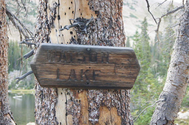
I came out above Cliff and found the trail I wanted. As I hiked along the trail I passed Petite and linear lake just before passing Lake Watson; that is Mount Watson in the background.


The trail is quite confusing after Watson and evidently I took the wrong junction. So out came the map and I bushwhacked into Cliff Lake.

After passing Cliff, I passed by Booker and the two other Divide lakes. After leaving the last Divide lake I Bushwhacked up to another lake north of the last Divide lake. There isn't a name on the map and it looks like fishless pond, but it sure is beautiful.

After leaving the dead pond I followed the outlet down to Hidden. To my dismay I found it wasn't hidden enough because there were five campers there already. So much for my new secret fishing hole! Well I was hoping anyway, it isn't really that far in so I shouldn't have expected it! A boy can dream can't he?

I said hello to the fellas that beat there and walked to the other side of the lake. After crossing the outlet I ran into this beautiful doe and she was nice enough to let me take her picture.

My view from the camp site!


My secret weapon for warm water! Two of these in a Nalgene are yummy and help with silt taste from some of the glacial lakes I have filtered water from. Even the best filters can't keep all of the bad taste out.

I tried fishing that evening after dinner and nothing, there were a few boils in the middle but they didn't want to play. I hit the bag around 9 pm and slept on and off until 6:30 am. which is very late for me. I slept pretty good considering that this was my fisrt solo trip this far in.

This is the view I awoke to, absolutely no wind! Perfect fishing weather except the rotten fish didn't want to cooperate!

This Divide lake is on the Weber drainage side, the divide lakes are cool because one of them drains into the Weber river and the one next to it ends up into the Provo river. These lakes have fish but they didn't want to play either!

Weber side.


Provo side.

The third lake is Booker.

Next to Booker is Clyde lake, a few fish were rising so I tried my luck. I saw this fella rise and threw my fly and bam fish on!

Not a very big fish but very pretty, he ended up being the only fish of the trip.

My parting shot of Clyde Lake.

Unknown lake below Clyde.

Watson again.

Cliff Lake.

One of the cliffs at Cliff lake.


One of the Lily lakes, I wonder why they call it lily?

The trail marker.

Tragedy! Did it get broken defending myself from a charging black bear? Nope. Did I break it defending my self from a sword wielding rabid squirrel? Nope. Did I break it fighting a the new world record Brook trout? Nope, as I was coming down the last set of switch backs before Lily lake I slipped onto my rear end and when I came down the tip snapped! As I picked myself up off the ground I noticed the broken rod. I composed myself after the blood cuddling scream,wiped my tears and sulked all the way back to my car! What a horrible way to end an awesome trip, I was able to keep from breaking down completely long enough to make it to the car. I sucked my thumb the whole way home!

The final picture says it all!

Keep you lines and boot laces tight.